
What does 1:25,000 map scale mean? A distance guide
A map ratio turns a measured line into ground distance, but the result depends on scale, output size, and whether you follow a route.
A map scale is a ratio between a distance on the map and the matching distance on the ground. In 1:25,000, one unit on the map represents 25,000 of the same units on the ground. Measure 2 centimetres on that map and you have 50,000 centimetres, or 500 metres, on the ground.
That ratio answers a distance question. It does not tell you whether a line is a public path, how long a journey will take, or whether a route is suitable for a person. For those questions, read the map's legend and the current local information alongside the measurement.
Key Takeaways
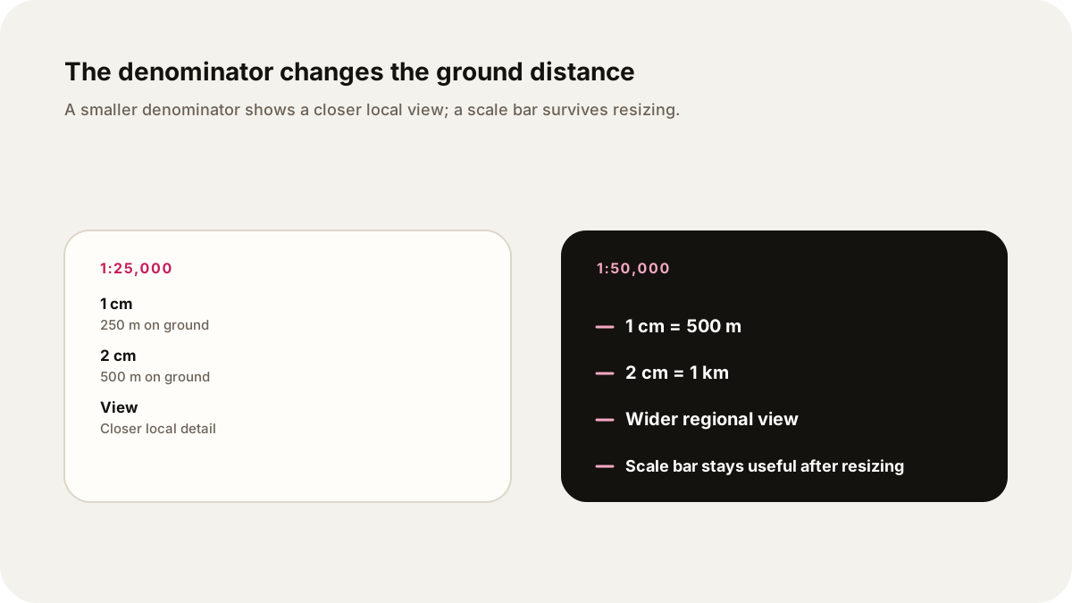
- In 1:25,000, 1 cm represents 250 m. In 1:50,000, 1 cm represents 500 m.
- The smaller denominator, 25,000, is the larger map scale. It normally shows a smaller area with more detail.
- A straight-line measurement and a route measurement answer different questions.
- Resizing changes the printed size, so a ratio can stop being true. A scale bar resizes with the map and can restore a usable reference.
What does 1:25,000 mean?
The first number describes map distance and the second describes ground distance in the same unit. A 1:25,000 map therefore says:
1 cm on the map = 25,000 cm on the ground
                  = 250 m
                  = 0.25 km
The U.S. Geological Survey gives the same kind of reading for a 1:24,000 map: one inch on the map represents 24,000 inches, or 2,000 feet, on the ground. The unit can be inches, centimetres, or another unit. The relationship stays the same as long as both sides use the same unit.
The ratio is a statement about the map as produced. It is not a label for how detailed a place is in real life. A detailed map can still omit a feature, use a symbol, or simplify a boundary. Read the legend before treating a line or blank space as evidence about the landscape.
The 2 cm and 500 m example
Suppose a map is marked 1:25,000 and the distance between two points measures 2 cm. Multiply the map measurement by the denominator:
2 cm × 25,000 = 50,000 cm
50,000 cm ÷ 100 = 500 m
500 m ÷ 1,000 = 0.5 km
So 2 cm on a 1:25,000 map represents 500 metres, or half a kilometre, on the ground. The same calculation works for 7 cm:
7 cm × 25,000 = 175,000 cm
175,000 cm = 1,750 m
1,750 m = 1.75 km
These are worked examples, not measurements from a particular trail or street. A reader can use the same method with a ruler, or use the scale bar if the map includes one.
Is 1:50,000 larger or smaller scale?
1:25,000 is the larger scale. The denominator is smaller, so each centimetre represents less ground. That usually lets the map show a smaller area with more local detail. 1:50,000 is the smaller scale. Each centimetre represents twice as much ground, so the sheet can cover a wider area but usually gives less detail for the same printed size.
| Map scale | 1 cm on map | What it is useful for |
|---|---|---|
| 1:25,000 | 250 m | A closer view of a local area |
| 1:50,000 | 500 m | A wider regional view |
The U.S. Geological Survey describes 1:24,000 maps as showing an area in detail and 1:50,000 to 1:100,000 maps as covering larger areas with less detail. Natural Resources Canada gives the practical conversion 1 cm = 500 m for its 1:50,000 topographic maps. These descriptions refer to the published map scales. A digital viewer may change the display size without changing the source data.
What resizing does to the ratio
The ratio belongs to the map's physical output. If a 1:25,000 map is enlarged to twice its original size, 2 cm on the enlarged copy may represent the same ground distance that 1 cm represented on the original. The printed ratio is now effectively 1:12,500. If the map is reduced to half size, the effective ratio becomes 1:50,000.
That is why a printed ratio can mislead after photocopying, exporting, or changing a PDF's print setting. Check whether the map says “print at 100%,” or use its scale bar. The bar grows or shrinks with the map, so it remains a direct visual comparison when the map and bar are resized together. Natural Resources Canada advises using the scale bar at the bottom of its topographic maps to measure distances.
The same caution applies to screenshots. A display may show a scale indicator for its current zoom, but a screenshot can lose that relationship when inserted into another document. Keep the bar and its units visible, or record the map's scale and the output size.
Straight-line distance versus route distance
A ruler between two points gives a straight-line distance. It is the shortest geometric separation between those points on the map's surface, subject to the map's projection and the accuracy of the measurement. It does not follow bends in a road, river, footpath, or boundary.
To estimate a route, trace the route in short sections. Add the sections together after converting them with the map scale. A strip of paper or a piece of string can follow curves on a paper map. A digital map may have a route tool, but check which line it is following and which map data it uses.
For example, a straight line might measure 2 cm on a 1:25,000 map, giving 500 m. If the visible path bends and the traced path measures 3.2 cm, the mapped route is 800 m:
3.2 cm × 25,000 = 80,000 cm = 800 m
That calculation describes map geometry. It does not predict walking time, surface conditions, access, weather, closures, or safety. The map's symbols and a current local source are needed for those decisions.
A simple audio explanation
An audio guide should say the scale before it reads a distance. A useful request is: “Explain this 1:25,000 map for a general listener. Define the ratio, work through 2 cm as 500 m, compare it with 1:50,000, explain what happens after resizing, and separate straight-line distance from the route traced along a path. Do not estimate travel time or give safety advice.”
This keeps the arithmetic audible. It also gives the listener a check: 1 cm is 250 m, so 2 cm must be 500 m. For a historical sheet, add the date, maker, legend, and archive record. The guide to reading an old map shows how to separate what a map displays from what it cannot prove. For another worked explanation, see percentage points and percent change, which also labels the starting unit before doing the arithmetic.
Sources
- U.S. Geological Survey, US Topo Map Symbol Guide, retrieved October 8, 2026: 1:24,000 ratio and the 2,000-foot inch conversion.
- U.S. Geological Survey, USGS Maps booklet, retrieved October 8, 2026: large and small scale terminology and detail differences.
- Natural Resources Canada, Topographic Maps: Tips and Hints, retrieved October 8, 2026: 1:50,000 and 1:250,000 conversions and scale-bar guidance.
- Natural Resources Canada, Topographic Maps: The Basics, retrieved October 8, 2026: scale-bar measurement and 1 cm = 500 m at 1:50,000.
- Ordnance Survey, What is cartography?, retrieved October 8, 2026: ratio definitions and 1:25,000 and 1:50,000 examples.