
Low Earth or geostationary? A listener's guide to satellite orbits
A satellite's height changes how fast it moves, how much of Earth it sees, and what a weather or communications mission can do.
When you hear “satellite,” it helps to ask one question first: how high is it? A low Earth orbit satellite crosses the sky quickly and sees a smaller area at close range. A geostationary satellite sits far above the equator and keeps watch over nearly the same region. The orbit is part of the explanation, not background decoration.
Start with altitude and period
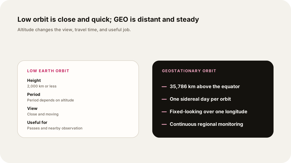
NASA defines low Earth orbit, or LEO, as an Earth-centered orbit at 2,000 kilometers or less above the surface. The International Space Station is in LEO. ESA describes spacecraft in LEO circling Earth in about 90 minutes, although the exact period depends on the altitude and orbit shape. NASA’s catalog of Earth satellite orbits gives a useful comparison: the Aqua satellite takes about 99 minutes at roughly 705 kilometers, while a satellite near geostationary altitude takes almost a day.
Geostationary orbit is a special case of geosynchronous orbit. ESA places it at 35,786 kilometers above the equator, with an orbital period matching Earth’s rotation. A circular orbit over the equator can therefore appear fixed over one longitude. A geosynchronous orbit that is tilted or elliptical can move north and south or east and west in the sky, so “geosynchronous” does not always mean motionless.
That distinction gives you a clean opening for an audio episode: LEO is a nearby, fast trip around Earth; geostationary orbit is a distant match to Earth’s spin.
What the two views let you notice
At lower altitude, a satellite travels quickly over the surface. That is useful for observing changing areas, collecting detailed measurements, or putting a crewed station close enough for regular access. The view is local at any one moment, and a ground antenna may see the spacecraft only during a pass unless a network of satellites or stations extends coverage.
At geostationary altitude, the satellite sees a much larger part of Earth. ESA says this makes GEO useful for communications and continuous weather monitoring. NASA’s GOES mission page describes the weather satellites as orbiting 22,236 miles above the equator at a speed that matches Earth’s rotation, allowing continuous coverage of assigned regions.
The trade is distance. A geostationary satellite is far away, so a signal travels farther and the satellite is not equally useful for every latitude. A LEO satellite can pass close to a location, but it moves on. Neither orbit is “better” in general. The mission decides which view and timing matter.
A worked comparison
Suppose you want an audio explainer about a storm forming over one ocean basin. A geostationary weather satellite can keep returning images of the same broad region, making it useful for watching cloud systems develop. A LEO satellite may pass over a narrower strip and collect a different kind of detail. The two observations answer different questions: what changed across a wide area over time, and what did a close pass measure along its route?
NASA also explains that a satellite’s altitude changes its speed. Closer to Earth, gravity is stronger and the orbital speed is higher. At the geostationary distance, the satellite moves more slowly while covering a much larger circle. The orbit period is the visible consequence of that geometry.
Make the question precise before recording
Use four prompts to shape a short episode:
- Ask whether the listener wants altitude, speed, coverage, or a satellite’s job.
- Name the orbit class and give the approximate height.
- Explain the period and what a ground observer sees.
- End with the limit: a fixed-looking satellite is not fixed in space, and a fast LEO pass is not a complete view of Earth.
Example show request: “Explain low Earth orbit and geostationary orbit for a curious beginner. Compare altitude, travel time, coverage, and one weather use. Use NASA and ESA sources, define geosynchronous versus geostationary, and keep it to six minutes.”
Ask Lissin for the comparison in the form you want to hear: a calm lesson, a short question-and-answer, or a source-led briefing. Add the NASA and ESA links so the episode can keep the numbers and definitions attached to their sources. For a related example of turning a space question into an audio structure, see the gravity-assist explainer. The October skywatching guide takes a different route, from what you can observe to what an audio guide can explain.
Sources
- NASA, Catalog of Earth Satellite Orbits: altitude, speed, orbit periods, and geostationary coverage.
- NASA, Commercial Low Earth Orbit Frequently Asked Questions: LEO definition at 2,000 kilometers or less.
- NASA, GOES mission: geostationary altitude, equatorial orbit, and continuous regional monitoring.
- ESA, Spacecraft orbits: LEO timing and the distinction between geostationary and geosynchronous orbits.
- ESA, Types of orbits: LEO and GEO altitude ranges and uses.