
True north vs. magnetic north: how to read a bearing
A map bearing and a compass bearing can name different norths. Separate the reference lines before you add or subtract a declination value.
Have you ever set a compass to a bearing from a map, then wondered why the needle disagrees? The usual cause is different norths. True north points toward the geographic North Pole. Magnetic north is the direction of Earth's magnetic field at your location. Grid north is the direction of the map's north-south grid lines.
Key Takeaways
- True north follows geographic meridians. Grid north follows the map's projection grid.
- A magnetic compass follows the local magnetic field, so its direction can differ from true or grid north.
- Magnetic declination is the signed angle between magnetic north and true north. It changes with location and time.
- Here, true bearing = magnetic bearing + declination. Name the convention before calculating.
What do the three norths mean?
True north is the direction toward the geographic North Pole. Magnetic north is the direction a compass points at that place and time. It is not a fixed arrow that can be copied from one town, map, or year to another. USGS explains why magnetic north varies with both position and time.
Grid north belongs to the map. A projected map turns part of the curved Earth into a flat coordinate grid, and the vertical grid lines define it. They are not automatically identical to true north. The Ordnance Survey's compass guide defines both terms.
When a printed map shows three arrows, read the diagram instead of assuming the top edge means true north.
What is magnetic declination?
Magnetic declination is the angle between magnetic north and true north. NOAA's magnetic declination service uses positive values for magnetic north east of true north and negative values for magnetic north west of true north. The value depends on where you are and the date for which it was calculated.
Use this explicit convention:
true bearing = magnetic bearing + declination
If declination is east, it is positive. If declination is west, it is negative. NOAA states that you can obtain a true bearing from a magnetic bearing by adding the magnetic declination. A local map or calculator supplies the value. This guide does not assign a current declination to any real route.
A hypothetical bearing, with the sign shown
Imagine a fictional map and compass exercise. The map gives a true bearing of 090°, due east. The exercise also supplies a deliberately hypothetical local declination of +8° east, meaning magnetic north is 8° east of true north. What magnetic bearing should the compass follow?
Start with the stated conversion and rearrange it:
true bearing = magnetic bearing + declination
090° = magnetic bearing + 8°
magnetic bearing = 090° − 8°
magnetic bearing = 082°
In this invented exercise, the compass bearing is 082°. A compass pointing 082° magnetic represents a 090° true direction because its north reference is offset eastward by 8°. The 8° value is a teaching premise, not a live reading. For a real place, obtain a current declination for the coordinates and date, then check whether the map's bearing is true, grid, or magnetic.
If the map instead gave a magnetic bearing of 082° and the same +8° east declination, the forward calculation would be 082° + 8° = 090° true. Write “magnetic” and “true” beside each number.
Where grid north enters
A topographic map may give you a grid bearing measured from its vertical grid lines. That is different from a true bearing. The USGS north-arrow explanation shows all three arrows and explains that projection and location create the grid-to-true difference.
So a complete conversion can have two stages: grid to true, then true to magnetic. The map's marginal diagram tells you the angles and their signs. Do not apply magnetic declination to a grid bearing while treating the grid as true. If an app has already applied a correction, record that setting before adding another one.
A useful listening request
For a source-led audio explanation, give Lissin the map legend or north-arrow diagram and ask:
“Explain whether this bearing is true, grid, or magnetic. Define the three norths, read the declination sign from the map, convert the bearing with the equation shown, and label every intermediate value. Use the supplied location and map date only. If the diagram is missing, say which value is unknown. Do not give a current route or safety guarantee.”
That request keeps a general explanation separate from live navigation. The guide to reading an old map covers date, purpose, orientation, and legend. The 1:25,000 map-scale guide shows why a distance measurement also needs a named map reference and unit. For source and correction habits, see source links and corrections for AI audio.
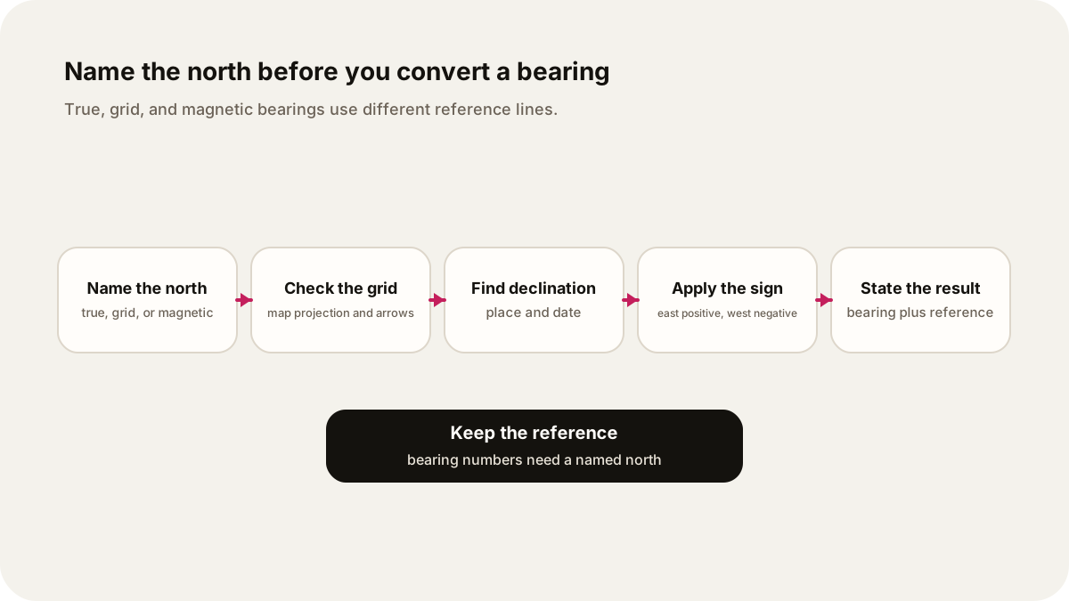
Before using a compass, name the north, check the map's grid, retrieve a current declination for the place and date, and write the sign into the arithmetic. The needle answers a magnetic question. Your map may ask a geographic or grid question. Keep them distinct.
Sources
- NOAA NCEI, Magnetic Declination: definition, east-positive sign, and conversion from magnetic to true bearing.
- U.S. Geological Survey, What do the different north arrows on a USGS topographic map mean?: true, grid, and magnetic north on a map.
- U.S. Geological Survey, What is declination?: location and time dependence of declination.
- Ordnance Survey, Compasses and Directions: plain definitions of true, grid, and magnetic north.